
Features Topography On the Fly
Topography On the Fly is a suite of land surveying tools.
It allows you to have complex surveying calculations on the field quickly with maximum accuracy.
The design is as simple as needed under work pressure.
The advantage is that can be used only with a simple total station or additionally with more complex instruments and gps.
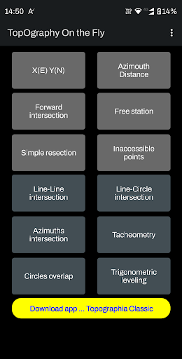
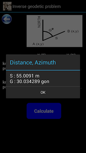
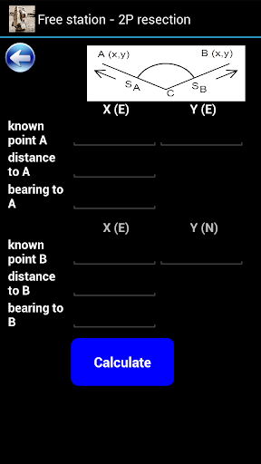
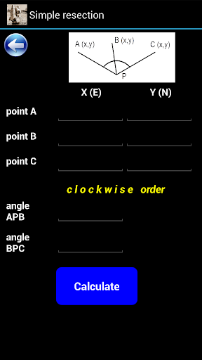
Angular units : gradians (default) and decimal degrees (degrees only in Distance/Azimuth).Task list:Direct geodetic problemInverse geodetic problemSimple forward intersectionTwo points resection – Free stationSimple resectionInaccessible pointsLine-line intersectionLine-circle intersectionAzimuths intersectionTacheometryCircles overlapTrigonometric levelingGreat tool for land surveyors, civil engineers, topographers and land engineers.Download also our free application:"Geodetic NET" from Google playhttps://play.google.com/store/apps/details?id=com.GeodeticNET&hl=en"Surveying In the Field" from Google playhttps://play.google.com/store/apps/details?id=com.Surveying.IntheField&hl=en"Topographia Classic" from Google playhttps://play.google.com/store/apps/details?id=com.Topographia.Classic&hl=en&gl=USDont forget to rate this app and send us a feedback.
Secure & Private
Your data is protected with industry-leading security protocols.
24/7 Support
Our dedicated support team is always ready to help you.
Personalization
Customize the app to match your preferences and workflow.
See the Topography On the Fly in Action
Get the App Today
Available for Android 8.0 and above